LOCATION AND OWNER
- Address: Krabyskogen næringsområde, Østre Toten municipality, Norway
- Coordinates: 60°39’07.1″ N 10°52’43.3″ E
- Map: https://goo.gl/maps/vUKPEGc8VFJ2
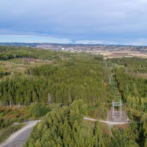
- Surroundings: Forest
- Owned by: Private landowner
SITE AND CONSTRUCTION
- Site area: 80.000 m2. 1.000,000 m2 (1000 ha) Q2 2023
- Topography: Flat
- Type of site: Greenfield
- Shape: Rectangular
- Utilization: 90%
- Construction: Easy deforestation, due to thin soil. Flat and a little hilly and well suited for construction.
ELECTRICITY AND GRID
- Short term potential: (<6 months): 9 MW
- Mid term potential (18-24 months): 9 MW
- Long term potential (60> months): 15 MW*
- Grid: 132 kV
*New substation Skyberg 300-132 kV will improve capacity (2026).
Transformer 145 kV at site. For more information regarding electricity and grid capacity contact us. All infrastructure upgrades is required to comply with Norwegian regulation processes.
CONNECTIVITY
- Dark fiber: Two independent international feeds with possibility for one more
- Operators: Eidsiva, Telenor, GlobalConnect
- Connect EU: Østre Toten is close to GlobalConnect main fiber routes going towards Oslo, Stockholm and mainland Europe. Possibilities to connect to major international operators in Oslo / Stockholm.
PLANNING AND PERMITTING
- Regulations: Regulated for industry. Ordinary building permits are required
- Zoning: Zoned for industrial purposes.
- Road: Yes, on site
- Water/Sanitary: Yes, on site. New water/ sanitary at customer needs
- Cooling water: Yes, a big river 400 meters from site.
SITE ACCESS
- Highway: 3500 meters from RV 33 (main road to Oslo/Trondheim)
- Access: Existing road access to the site
- Int. airport: OSL Gardermoen, 60 min, 80 km
- Train: Gjøvik station (train to Oslo), 20 km away