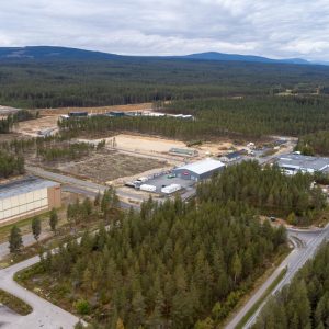
LOCATION AND OWNER
- Address: Grundsetmoen næringspark, Elverum, Hedmark, Norway
- Coordinates: 60°54’26.3″N 11°30’52.0″E
- Map: https://goo.gl/maps/gn6ovdTnL812
- Surroundings: Forest
- Owned by: Elverum municipality
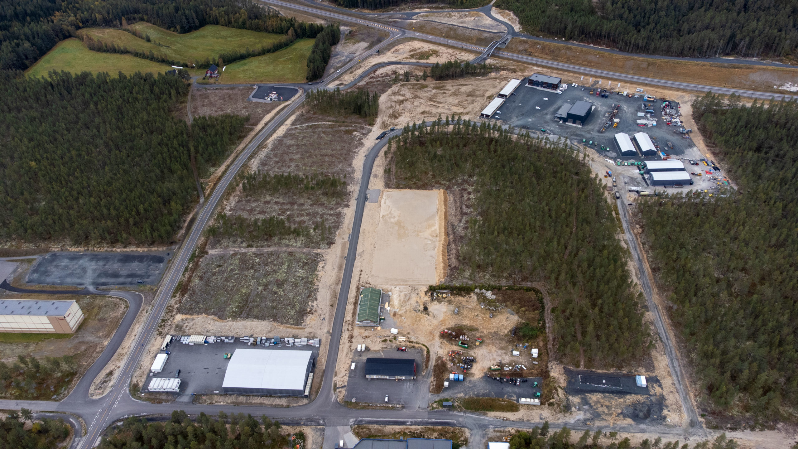
SITE AND CONSTRUCTION
- Site area: Greenfield 400.000 m2 (150 ha)
- Topography: Flat
- Shape: Rectangular
- Utilization: 70%
- Construction: Extremely easy deforestation, due to thin soil. Naturally levelled, fluvial gravel ground, well suited for construction.
ELECTRICITY AND GRID
- Short term potential: (<6 months) : 9 MW
- Mid term potential (18-24 months) : 100 MW
- Long term potential (36-60 months): 100 MW
- Grid: 132 kV
For more information regarding electricity and grid capacity contact us. All infrastructure upgrades is required to comply with Norwegian regulation processes.
CONNECTIVITY
- Dark fiber: Four independent international feeds with possibility for two more
- Operators: All major Norwegian operators (Eidsiva, Telenor, GlobalConnect)
- Connect EU: Elverum’s proximity to the Swedish border gives possibilities to connect to major international operators in Stockholm, as well as international connections through Oslo.
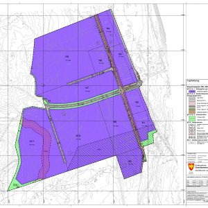
PLANNING AND PERMITTING
- Regulations: Regulated for industry. Ordinary building permits are required
- Zoning: Zoned for industrial purposes.
- Road: Yes, on site
- Water/Sanitary Yes, on site. New water/ sanitary at customer needs
- Cooling water: Yes, a big river 400 meters from site.
SITE ACCESS
- Highway: 2-300 meters from RV 3/25 (main road to Oslo/Trondheim)
- Access: Existing road access to the site
- Int. airport OSL Gardermoen, 70 min, 100 km. New four lane motorway in 2020.
- Train: Elverum station (train to Oslo), 3 km away