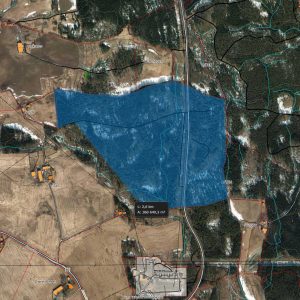
LOCATION AND OWNER
- Address Heggvin/Vang Trafo, Arnsetvegen, Hamar, Norway
- Coordinates (N) 60.841118810548664 (E) 11.269668103050207
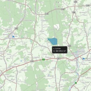
- Map https://goo.gl/bpNMDJ
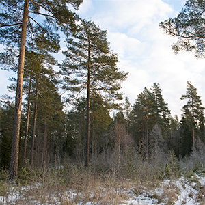
- Surroundings Forest, naturally levelled
- Owned by Hamar municipality, through agreements
SITE AND CONSTRUCTION
- Site area 1.000.000 m2 (100 ha), greenfield.
- Topography Flat, 270 meters above sea level
- Type of site Wood and grassland. Granite gravel (moraine)
- Shape Rectangular
- Utilization 60 % – based on roofed area
- Construction Easy deforestation. The granite gravel ground is flat and well suited for construction.
ELECTRICITY AND GRID
- Within 3 months –
- Within 18 months 150 MW
- Long term potential (36 – 60 months) 150 MW
- Grid 300 kV TSO passing by site
Must establish infrastructure to nearby trafo (Vang trafo, 300 kV TSO/central grid, distance 200 meters)
For more information regarding electricity and grid capacity contact us. All infrastructure upgrades is required to comply with Norwegian regulation processes.
CONNECTIVITY
- Dark fiber Three independent international feeds can be provided.
- Operators Eidsiva bredbånd (on site), GlobalConect (on site), Telenor (max 5 km from site)
- Connection to EU Hamar is close to the Swedish border with connections directly to major international operators in Sweden, as well as international connection through Oslo.
PLANNING AND PERMITTING
- Regulations Regulated for datacenter use and industry.
- Zoning Industrial zoning ready for construction
- Water/Sanitary Yes, on site – new water/ sanitary at customer needs
- Building height: There are no restrictions to building height
SITE ACCESS
- Highway 1 km from RV 25, 12 km from E6 (main road from southern to northern Norway). 3 km from exit, motorway
- Access Existing road access to the site
- Int. airport OSL Gardermoen, 60 min, 90 km. New four lane motorway.
- Local airport Hamar, 20 min, 14 km
- Train Hamar st, Dovrebanen, 14 km away